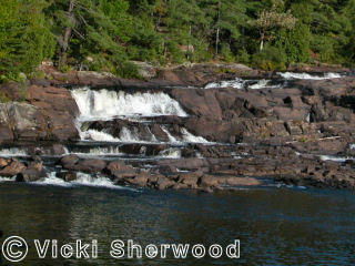
Niagara Escarpment in Hamilton.
On Red Hill Creek.
Very steep ramp waterfall with two 7 to 8-metre drops.
In mid-April after a winter with a lot of snow there was lots of water to make the falls really impressive. This photo was taken from the viewing platform beside the car park on Mountain Brow Blvd, just west of Pritchard Rd.
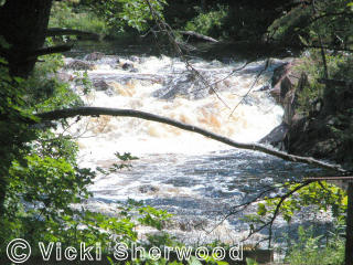
Albion Falls:
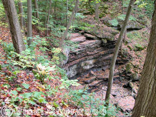
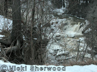
Niagara Escarpment in Hamilton.
On Red Hill Creek.
Very steep ramp waterfall with two 7 to 8-metre drops.
This photo was taken from the foot of the falls. There is a very rough
path from the car park at the end of Mud St. just east of Pritchard Rd.
It is not for the faint-hearted.

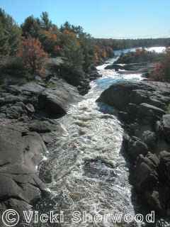
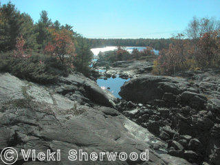
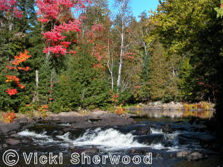
Niagara Escarpment near Lincoln.
On Twenty Mile Creek.
Plunge waterfall with 11-metre drop.
In mid-April after a winter with a lot of snow, there was lots of water. The falls can be dry in the summer.
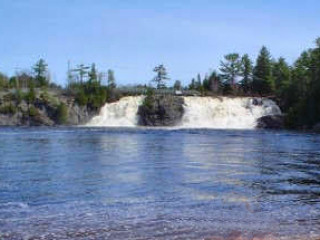
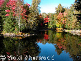
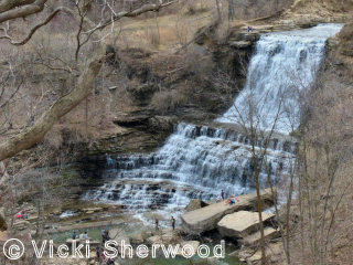
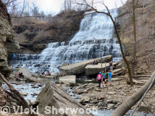
Lower Ball's Falls:
Niagara Escarpment near Lincoln.
On Twenty Mile Creek.
Plunge waterfall with 27-metre drop.
When we were there in mid-April, there were salmon spawning in the river
a short distance below the falls. The falls can be completely dry in summer.


Ball's Falls:
Ball's Mills (Glen Elgin) ghost town.
On Twenty Mile Creek at Lower Ball's Falls.
The Ball family were United Empire Loyalists who came to Canada from near
Albany, New York, in 1783 after the American Revolution. By 1852 there
were 19 people living in the hamlet, including a blacksmith, cooper, weaver,
tailor, butcher and spinners. This church, St. George, was built in Hannon
in 1864 and moved here in 1976.
Ball's Falls:
Ball's Mills (Glen Elgin) ghost town.
On Twenty Mile Creek at Lower Ball's Falls.
As well as the Ball family house and barn, there is this grist mill (1809),
a tool shed, smoke house, bake oven, tenant's house, lime kilns, and a
blacksmith's shop. A ruined woolen mill is on the way to the upper falls.
2 other houses and the church have been moved to the site.

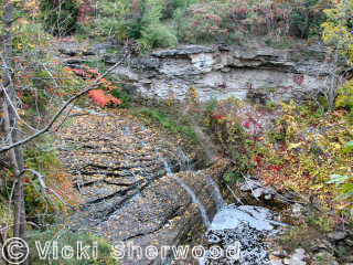
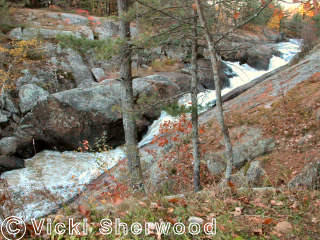
Niagara Escarpment near Grimsby.
On Forty Mile Creek.
Ramp waterfall with 9-metre drop.
Early October 2012 after a very dry summer so there is not much water.
Beamer Falls:
Niagara Escarpment near Grimsby.
On Forty Mile Creek.
Ramp waterfall with 9-metre drop.
Early October 2012 after a very dry summer so there is not much water.


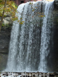
Niagara Escarpment near St. Catherines.
On Twelve Mile Creek.
Plunge waterfall with 22-metre fall.
We hiked from below the lower falls all the way to the foot of the upper falls. The trail was terrible; scrambling up beside the lower falls wasn't too bad but coming back down was scary.
Morningstar Mill (1872) at top of upper falls.
.
Niagara Escarpment near St. Catherines.
On Twelve Mile Creek.
Plunge waterfall with 22-metre fall.
There was no way we were going to try the hike to the foot of the falls in the winter.
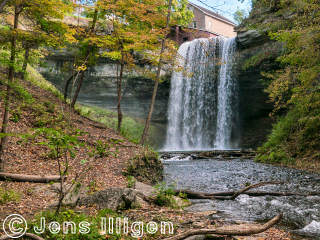
Niagara Escarpment near St. Catherines.
On Twelve Mile Creek.
Plunge waterfall with 22-metre fall.
It is a really beautiful waterfall when seen from below. It would be so nice if there were a safe trail. Photo taken by Jens Illigen.
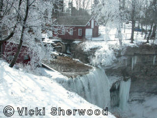
Niagara Escarpment near St. Catherines.
On Twelve Mile Creek.
Plunge waterfall with 22-metre fall.
My daughter tried her best to get a photo of the falls without Morningstar Mill at the top. She almost succeeded. Photo taken by Kim Sherwood.
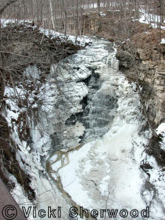
Niagara Escarpment near St. Catherines.
On Twelve Mile Creek.
Steep cascade waterfall with 8-metre fall.
There was no way we were going to try the hike to the lower falls in the winter.
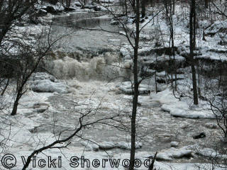
Niagara Escarpment near St. Catherines.
On Sixteen Mile Creek.
Plunge waterfall with 8-metre fall.
In early October after a very dry summer, the waterfall was completely dry.

Niagara Escarpment near St. Catherines.
On Sixteen Mile Creek.
Plunge waterfall with 8-metre fall.
In early March there was lots of water but it was much too icy to get really close to the falls.
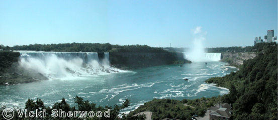
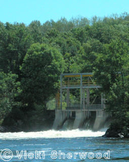
Niagara Falls

Niagara Falls. Horseshoe Falls:
Niagara Escarpment at Niagara Falls.
On Niagara River.
Plunge falls with 53-metre drop. 671 m wide.
About half the water is diverted for hydro-electricity so the falls are
not eroding as fast as they naturally would. The water is about 3m deep
at the top edge and 52m in the pool below the falls. About 90% of the
water of the Niagara River goes over the Horseshoe Falls. For more photos
and more details, go to my
Niagara Falls page.
Niagara Falls. American Falls:
Niagara Escarpment at Niagara Falls.
On Niagara River.
Plunge falls with ~30-metre drop to boulders at base. 320m wide.
The Maid of the Mist boats have been taking tourists to the foot of the
falls since 1846. For more photos and more details, go to my
Niagara Falls page.

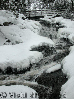
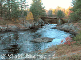
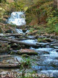
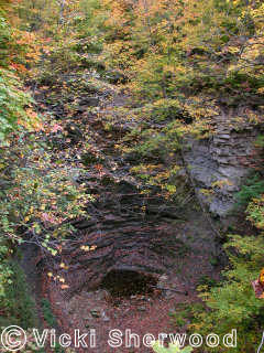
Niagara Escarpment near St. Catherines.
On Fifteen Mile Creek.
Plunge waterfall with 2-3 metre drop.
Seen from road bridge above main falls. Completely dry in October 2012 after a hot, dry summer,
Niagara Escarpment near St. Catherines.
On Fifteen Mile Creek.
Ramp waterfall with 18.3-metre drop.
We followed a little trail to the left behind the community centre - fine in summer but too dangerous in winter. The waterfall was completely dry after a hot, dry summer.
Niagara Escarpment near St. Catherines.
On Fifteen Mile Creek.
Plunge waterfall with 2-3 metre drop.
Seen from the trail to the right behind the community centre. Completely dry after a hot, dry summer.
Niagara Escarpment near St. Catherines.
Twelve Mile Creek.
Ramp waterfall with 16-m fall.
Also known as Dry Falls as it is often dry in summer and autumn.